

THE FIFE PILGRIM WAY
PART 2
DUNFERMLINE TO KELTY
We started again at the Abbey of Dunfermline ready for a game of hunt the Abbott, and we were not to be disappointed, ………….

The Abbott
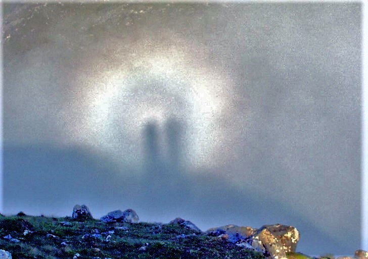
Broken Spectre cast on An Socach in the early hours as the sun rose. Pilgrims in the mist?
The Way is occasionally waymarked with the FPW symbol. Our previous frustrations were restoked with this second day of walking, the route being characterised by placement, mis-placement and non-placement of the signs. This was compounded by a map published on the site which was barely readable, and what was shown was vague. We suspect we may have walked the way. Or suspect we did.
Admittedly, the FPW is not ready but the the site cheerfully states “The delivery phase of the Fife Pilgrim Way Project is progressing towards completion with the official launch in early July. The path works, sign posting and waymarking are now complete, with the only outstanding issue being the restoration agreement relating to St Ninian’s opencast site.“ Oh really?!!?”
We’ll see.

14km down - St Andrews 78.5 km
Ridiculously enough, our struggle after the first leg of the walk where we tried to suss out where the walk started again was duplicated: we could not find the FPW logo anywhere. Where the finger points, no logo to be seen. Could be failing eyesight (you should see us struggling to see detail on the “Official Map”).
Turns out it’s head north to the High Street and follow the said High Street to the roundabout.

The Police Station is a big clue (and an impressive statue) but finding the route is a bit confusing: the marking doesn’t help, and the car park being built with a cycle way which disappears therein adds to the fun. So, cross the road by the police station, so up to the roundabout and cross to the carpark to get to Bellyeoman Road.

Pass the poorhouse, (now a nursing home), and head up to the Cemetery. The home is as it looks: shown on the (Fife and Kinross Sheet XXXIX.NW 1897) map, this building is the Leys Park Care Home, known in the 19th century as the Poorhouse. Unmistakeably. With the gate opening on to the cemetery….

DAFC Ground - the other side
This part of the walk was, well, a disused railway walk: dead straight, well-used on that Sunday morning by joggers, grandparents on grandchild duty, dog walkers etc. Most said hello, some didn’t. There was enough stuff going on to make sure we didn’t get the “will this never end” sensation where you can see the end but it never seems to get closer. I mean we had a bridge. We had an amusing sequence: old folks home (I know, I know but I think I can get away with it now I are an old folk), cemetery, hospital (round the corner). We did think this showed exemplary planning, and pondered over possible installation of the dearly departed from either side of the cemetery, a special arrangement perhaps?
Being a discursive sort of idiot, I did google Dunfermline, with a side order of “dunfermline scotland cemetery” and came up with:

Neil and I do tend to overthink these things, so KISS - head east toward the rising sun, walk past the north stand of the Pars and follow the old railway past the cemetery. i.e. Dunfermline Athletic Football Club. According to wikipedia (and this may be one of those wiki “facts”), the name’s derivation is:
"………. the more common belief that the name arose from the team's parallel striped shirts, their drinking habits or their style of play. The latter were both described as "paralytic". The earliest theory claims that in the early days when the Football Club was closely connected with the Cricket Club, the footballers were renowned for their performances at the bar and so were called the "Paralytics".”
Worth supporting them, just on that basis I would say.
I’m sure supporters Raith Rovers and Blue Brazil supporters will have picked up on proximity of ground to the cemetery, especially on a bad day for the Pars.

As someone who dabbles in family history and with not a few Fifers in the old tree, I was quite interested. But an entry under “tripadvisor.com”… well, maybe a little unfortunate I would say. But there again, maybe I can increase my score on tripadvisor.com?
A look at the 1853 map of the area shows the area as of that date. It shows the Jail on the Dunfermline side of the parliamentary border next door to the Poorhouse. It also shows, next in line, the Fever Hospital and the Dead House. Nice name. The cemetery (i.e. “the not around the old kirk” cemetery) was started next door sometime after 1843. The maps don’t say…. although the cemetery was extended. And they did build the new Queen Margaret’s Hospital after that. Efficient, if nothing else.

A spot to watch the hearses pass over…..
When the old trackbed hqs passed by the football park there’s a gateway that restricts motorcycles and such passing through. Shortly after is a bridge which the now cycle/walkway runs under. The extension to the Cemetery was serviced by a (then) new roadway which passed over the railway line. Neat place to have lunch on a sunny day, we thought.

So we flowed along the trackway until we hit the road that heads past the Queen Margaret Hospital (QMH) just after, well, the Queen Margaret Station. Popular sort of person that Queen Mags. Or Saint Mags as she became. Which by the way, is pretty damn central to this Fife Pilgrimage malarky.
The route takes you up the hill past the QMH to the Townhill Wood, where a tarmac-ed cycle and walkway has been built. In fairness, this is not the most stunning piece of coutryside, and frankly is a little boring. But it was easy walking and there were views of the Hill of Beath (240 m). Not stunning, but acceptable. And we reached the metropolis of Kingseat. According to the board as you reach Kingseat:
“The village of Kingseat was founded circa 1880 to house the miners and their families following the discovery of coal on the southern banks of Loch Fitty in the late 1800’s; the last coal was taken in 1946 when the mines were abandoned due to flooding.”
The board isn’t a board as such. It is a metal tablet which speaks of pride in place and heritage. The slightly boring coutryside has changed over the years, and what is now fields was once a cluster of pits, the Halbeath Colliery superseded by the finding of coal seams on the shores of Loch Fitty. The village of Lassodie was the focus of the workings here. The rise and fall of the Loch Fitty Colliery is documented (“Lassodie” below), and charts the creation and destruction of a community.
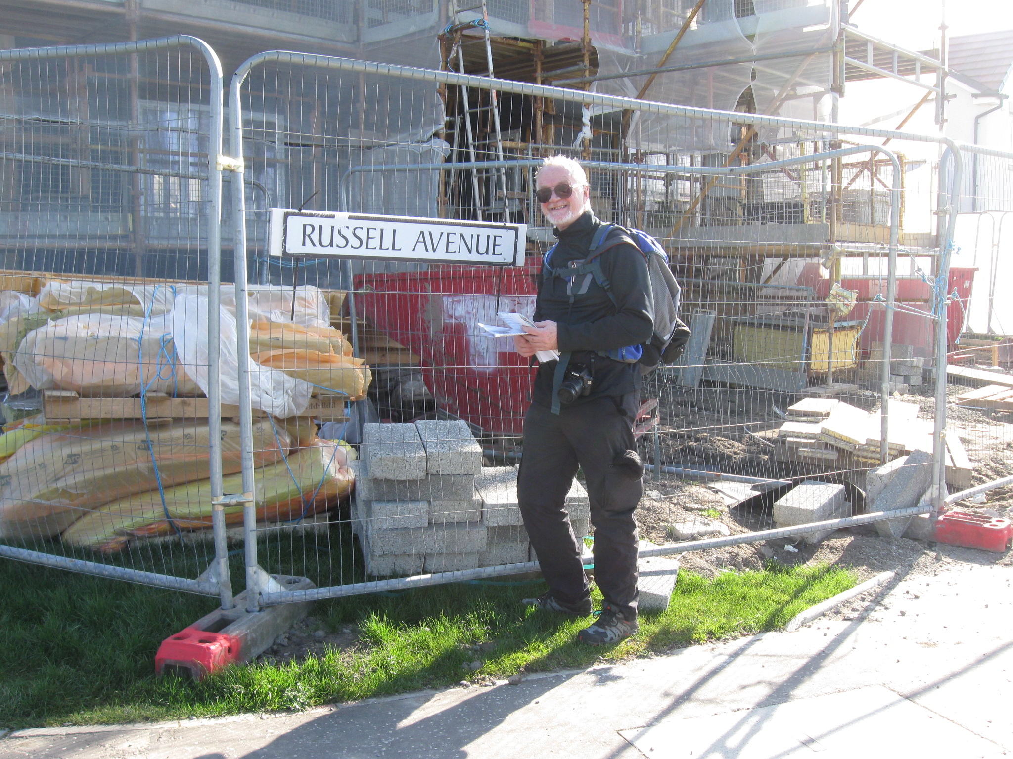
Civic honours for walkers
I was struck by a street name as we walked into Kingseat, and like to think that in its wondrous wisdom Fife Council (or Coonsil as they would have it hereabouts) had decided to honour my arrival at this point of the Pilgrim Way by, in anticipation, naming the road after me. Neil suggested, cruelly this was unlikely. Sometimes Neil is none too gentle.
We followed the road through Kinghseat, walking along what appears to be miner’s rows, and heading north toward Loch Fitty. This involved walking passed the Halfway Hotel, a large hotel and hostelry, complete with large car park. This may or may not be a going concern, but the hotel appears to have been built to serve a significant number of folk passing through. I kind of assume that the Half Way House in Kingseat is half way between Dunfermline and Kelty
The Half Way House lies diagonally opposite the much newer, snappily named Kingseat Community Leisure Centre which boasts outside a notice that shows that Kingseat has the Gold Prize for Best Village. And why not?

So we passed through Kingseat, reaching the brow of the hill at the end of the village, and saw Loch Fitty. The path follows the road then dives left to a gate and a pathway through bushes. We knew from the map that there was an abandoned railway track close by, and the line can be seen (past the bungalow) heading north east. Just another hint of a former age.

Loch Fitty

The route past Loch Fitty and the Open Cast Mine

The disused railway between gate and causeway

The gate to Loch Fitty

Funny I thought I had more hair than that….
The path beyond the gate was a welcome change. The organised dwellings, cars and tarmac paths disappeared and we followed a short pathway through shrubbery and scrub-ery. We followed the track towards the Loch, passing over the line of a disused railway, part of the old mining works. The path leads across a causeway…. and in our case, lunch. Scran,


It was a beautiful day, maybe a tad cool, but beautiful nonetheless. There was a few folk around, happy to say hello and to enjoy the causeway walk. Something magic about a cuaseway. This one was created from rock, no doubt found somewhere underground….
Lassodie is no longer on the map, and our pleasant picnic site was once the site of a mining comples with a village constructed to provide accommodation for its workers and their families. Mining is a theme throughout the central belt of Scotland, a history within a history. Those days have gone, and the dying was painful. Mining, as was, effectively ended with the Miners’ strike and the confrontation between Thatcher and Scargill. These days the critical issue of globing warming and CO2 emissions provides a sound reason why mining should have gone. But mining was a way of life, and mining communties had a character of their own. It was dirty and dangerous. As a southerner, someone from the East Anglia, it was beyond understanding, way different from the cultures that surrounded me as a child and as a young man (see comment above about lack of hair…). Why would someone fight to continue working a hundred metres below the surface in such conditions. Belonging? Belonging to a culture and community? Knowing what we are? Knowing who we are? Is that not a something?
After the crossing of the causeway, the route picks its way through a recvovering countryside with small reminders of its industrial past. This includes a now disused road which we had all to ourselves, apart from the encroaching scrubbery.
There is a memorial on the B912 heading north. It is a war memorial, but the men are also commemorated on the Scottish Mining Website.
Walking through villages, towns and cities within the Uk will usually mean passing close to the hundreds of war memorials, mostly First and Second World War memorials that record the names of men (and occasionally women) who lost their lives in war. Like many others, Lassodie and Kelty have memorials; the length of the list of names (three sides of them on the Kelty memorial: over 300 men) appear to speak of a disproportianate number of deaths. It is often said that the men enlisting in 1914 saw war as an adventure and an escape, young men with notions of immortality. For whatever reason they joined, be they voluntary or conscripted, I think that they need to be acknowledged. I rarely walk past war memorials: it feels like a duty.
The 1st World War was called the War to end Wars: on the Kelty memorial there are two added names:
PAUL K EASTON KOREA 1952
PAUL LOWE IRAQ 2004
Slow learners, the human race.

War Memorial, Kelty War Memorial Kelty, front War Memorial, Lassodie

The project at the St Ninians’ opencast site.

The Way passes the project mounds and the growing lake at the bottom of what presumably was the bottom of the open cast. There is masonry to indicate roads and loading platforms, but the path reaches the gate to the site which is locked. Walkers can walk round it. And search for those natty little Pilgrim Way signs. And not find them. As I have mentioned earlier. we erroneously followed the route into town. And found the bus, even on a Sunday…

To quote Douglas MacArthur “I shall return” (and in my case walk the right route). Bah.