
THE JOHN MUIR WAY
PART 3
PRESTONPANS TO EDINBURGH

JOHN MUIR MURAL, PRESTONPANS
24 March 2018
We caught the bus from Falkirk to get to Princes Street. It was a beautiful Sunday and we checked timetables to make sure that we hit the right stance. The bus had a few passengers waiting: it was a single decker, useful around town probably not the best for long haul journeys such as the 27 miles to Edinburgh. We followed our fellow travellers onto the bus, our Bus Passes in hand: mine from Falkirk, his from Fife. The ritual is that you clasp your card in your clammy mitt and press it onto the pad until it pings up for the driver, but you need to state your destination.
“Whaur ye goin’ tae?”
“Edinburgh. Put it on?”
Places card on pad.
“Aye”
Prints ticket.
“Thanks”
I make my way to the seat two thirds of the way back which is over the wheels and therefore higher than the body of the kirk.
Meanwhile, Neil is having a problem with the machine and the folk on the bus watch Neil’s struggle with the machine. I apologise to the passengers, and identify myself as his carer. Passengers chortle. Neil says something pithy, and the machine says “Yes”. “This” doesn’t happen in Suffolk, although in fairness I can’t remember being on a bus in Suffolk, this being an acknowledgement that a) someone else is nearby b) that you are there and c) that all are part of it, can hear it and would be allowed to comment or laugh.
Neil came down to stay with us in Suffolk for a week a few years back to help with some DiY stuff. I was working for part of the time, so Neil decided he’d walk into town (Sudbury, pop around 24000 – look it up on Wikipedia) and sample the local brews. So, off he trots.
Neil came back growling. He’d walked into the first pub in North Street. Ordered a pint, tried to strike up a conversation with the barman. Drawing teeth. Tried talking to another customer who by Neil’s account almost went into shock. Neil heads for the next pub and has pretty much the same result. Not a happy bunny when he got back, and he still refers back to the experience. Culturally, Neil’s culture is geographically close to Scotland and consequently far removed from that of East Anglia. Having a joke down the bus with other passengers joining in is not something that would happen in Suffolk, even on a bright Sunday morning.

It seems like all buses in Edinburgh go through Princes Street, so at 9:20 on a Sunday morning, there’s us: Neil and me, standing at a bus stop on Princes Street. Sunbathing. The walk has been incredibly un-rainy for all the walks so far. Amazing, and now we were basking in the sunshine awaiting a bus out to Prestonpans with an excellent view of both the castle and the bus stop opposite. Altogether a good start
Neil and I got off where we’d got on, in the main street of Prestonpans not far from “The Goth”.

This is the usual start of the day photo. Please note: Neil likes to wear Arthur’s Seat in his left ear. I favour the right.
I’d been to Prestonpans couple of years ago on one of our jaunts to Scotland to see family and, that time, friends. Old friends from Holland were over for a conference at the same time as Sarah, our favourite daughter( i.e. only daughter), was running a half-marathon. We’d motored across to Prestonpans in search of the course and in so doing had driven and walked along a bit of the route, which included the Prestonpans murals.
Sarah, (centre, pulling faces on the half marathon that passes through Prestonpans) is the éminence grise behind all this writing malarkey. She does techy stuff, and acts as an editor. “Acts” not being defined specifically as tragic or comic. She is primarily responsible for setting the blog out properly: the content is mine, the mistakes are hers. It’s her fault.
So, anyhow, I knew the murals were there.
Prestonpans is a pretty average-looking place, but is hooching with civic pride. The series of murals depict the history of Prestonpans, its people, its culture and its buildings. The project was initiated in 2000, and developed following visits to towns across the world who had created such murals as a focus of civic pride. The idea came from a small town on Vancouver Island where the main industry, a saw mill, closed down appearing to be the end of the township.
“Chemainus was a saw mill town on Vancouver Island, British Columbia, which faced no future when its MacMillan Bloedel mill closed. But it refused to die, and created the concept of telling the town's history on outdoor murals by leading Canadian artists .. and the tourists came to see. Today the small town is a byword for self help in the face of adversity. And in 2000 it opened its own theatre club as well.”
So Prestonpans has its murals, like Chemainus, like Kati Kati and like others. Prestonpans has a mural of John Muir, possibly because the John Muir Way was drawn through it but and perhaps because of a sense of connection with what Muir stands for. The Way has images of John Muir with its little purple badges, but this is something else. Each of the towns speak of the resistance of communities to economic decline.
Visiting Scotland with school friends after we finished school was memorable, and was informed by John Prebble’s books on Culloden, the Clearances and Glencoe; living in Scotland made that all the more accessible. My life in Scotland In the ‘80’s and ‘90’s was like being a spectator, perhaps a fan, seeing the changes taking place. I remember standing at a window looking out over the derelict Bathgate factory site, thinking about the Proclaimers and “Letter from America”. Seeing the disintegration of industries — Ravenscraig, the miners’ strike and ending of the pits with the ‘Gannet so near, the loss of Carron, ICI and the changes in a way of life I saw as a spectator, an Outlander. Where my children were born. Seeing communities re-discovering themselves, like Prestonpans and like KatiKati, which I have visited (accidentally), and Chemainus which I haven’t, asks questions that beg answers.
There is something about lost communities in Scotland and across the world, and something about pride in communities that lose their wealth but which reclaim their heart. There is something about “place”, something about belonging.

Looking toward Arthur’s Seat Winding Wheel, Prestongrange, Looking back towards the Law
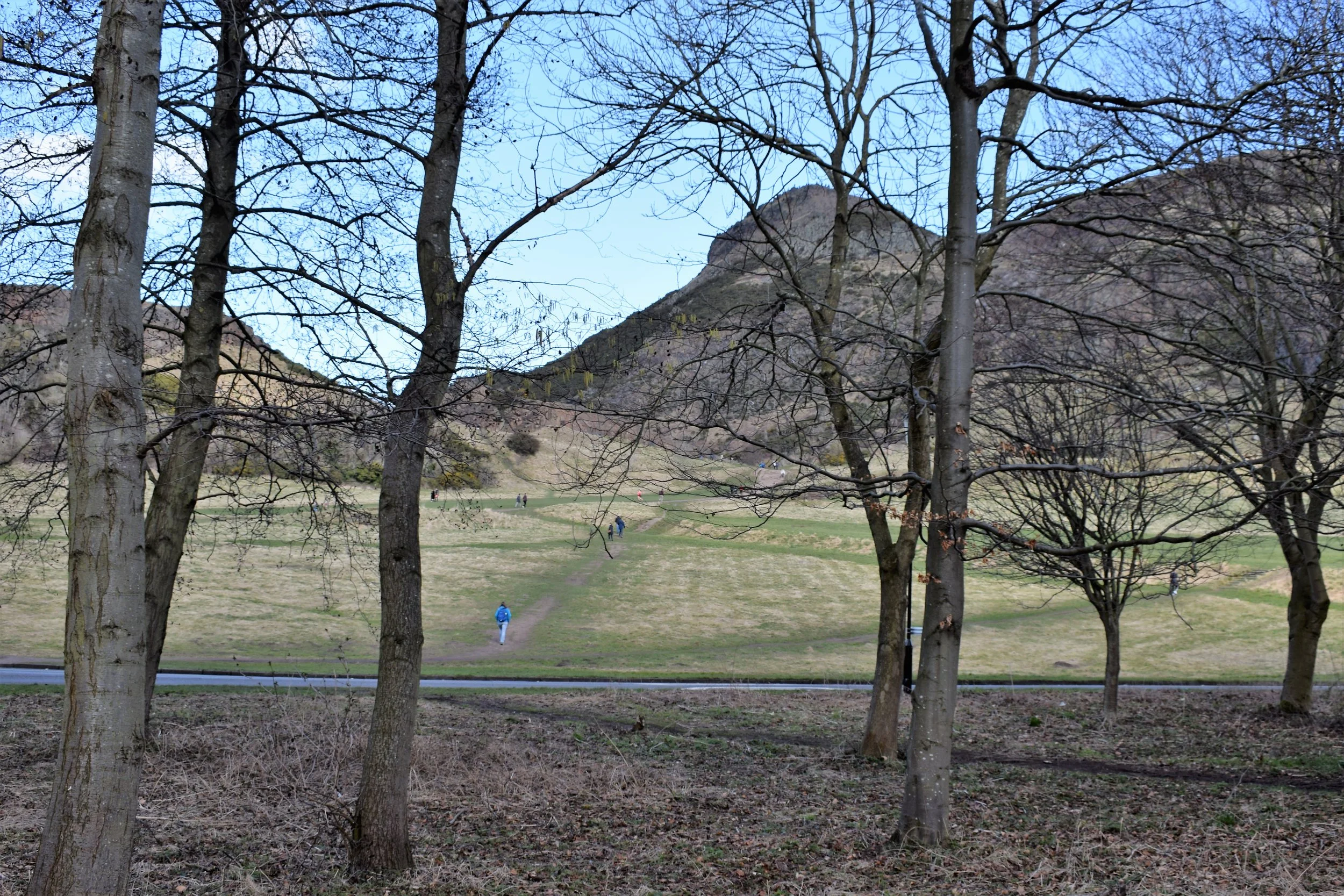
It was there again: at Prestonpans, we encountered once again the hill on the horizon. This time it was Arthur’s Seat that features. Arthur’s seat is very Edinburgh, and seems to be a thing. What it is is an extinct volcano. Still a thing. Like the Law. As I understand it, the seat is special for Edinburgh folk. I’m not sure why. It’s a Marilyn. Nuff said as far as I’m concerned. But the Edinburgh folk like it. And we were walking to it.
The way follows the coastline with views across the Forth to the Fife shore. Moving west, the shore is less coast and more estuary: the rocks are blacker, the sand thinner. Between Prestonpans and Musselburgh we pass the mining museum, the site of the Prestongrange Colliery at Morrison’s Haven. The winding wheel still stands above the pithead.
After Prestongrange, the Way heads towards Musselburgh, a dropping off point for our previous forays to the East. The Way leads between the Musselburgh Race Course and the Firth, passing the sites of demolished industry. It is being landscaped but still shows the odd piece of concrete or iron to remind us of the past.
The Way follows the coast line and picks up the River Esk as it meets the Forth: much seabird activity. Continuing you come across an ATC/AFC site, complete with arrow lining up WW2 bombers for the bombing range across the Forth. It is stll prominent from above. Take a look at the satellite images on Google Earth!

The Esk and the Jubilee Bridge
We follow the path beside the River Esk towards the ever so slightly worn Jubilee Bridge built to commemorate Vicky’s Diamond Jubilee in 1897. It replaced the ford. The River is fast flowing but quite shallow, and on the day the weather was amazing. It would have helped if I’d recharged my camera battery, but the phone camera made the most of the day.
Crossing the footbridge, we pass by the wee offspring of Lorreto School, the Nursery, at Pinkie Campus. I’d heard of Loretto and seen it before, just in the passing. But Pinkie Campus meant something: A-Level History and the doings and Rough Wooings of Henry VIII I were recognised. Another in the line of battles along the John Muir Way: Dunbar (twice) Prestonpans, Pinkie, Linlithgow Bridge, Falkirk (twice), Kilsyth…. A well-trod road.
The Jubilee Bridge is at the bottom of a U, so, having crossed you must walk back on yourself but across the river. According to the 1903 Musselburgh and District Directory the town was divided in two: Musselburgh and Fisherrow, the fishing port. The walk leads along the coast and arrives at Fisherrow. The promenade lined by tenements of various vintages, includes a large expanse of grass “The Links”. Walking toward the port has a sense of open-ness without the sense of seaside.

What was once a thriving fishing port, now a playground for weekend sailors
In the 19th century and before, the harbour which had been the centre of a vibrant fishing industry is now a valued memory, celebrated in photographs.
The harbour now shelters a flotilla of yachts, ready for a weekend’s sailing in the Forth.
We left Fisherrow and headed out on the road to, well, Helensburgh. Eventually. The way markers for the John Muir vary in their frequency: sometimes there’s a concern that lack of markers mean that you’re off track. At others, John and his beard appear with slightly over-enthusiastic regularity. The road leads to on one hand Portobello and on the other the City Centre. Always supposing you’ve missed the turn. Which we did. We overshot by about 40 meters only, but we have our pride. The entry is signposted to Newhailes but we could not find a JM sign but we found the path.

Considering the noise and bustle on the road we’d been walking down along, starting on the tree-lined path by the Brunstane Burn was startling, like walking into the country. The area opens out where was previously a flour mill complete with a mill lade and all the trimmings. The path (and cycle path) follows the line of the Burn past a rather quirky cemetery, expensive looking houses to the border between Edinburgh City and East Lothian at the railway bridge. The path runs under the railway (just for the record, it is the old North British Railway Line) with the usual inane grafitti. I mean who cares about the personal and interpersonal habits of the spotty youths and flossies of the area. Why do people think that they are so important that we need to put their personal lives on show, for whatever reason? Which appears to be what I’m doing. Oops.
So, we crossed the border into Edinburgh, slipping along the path by the burn with its seats and bushes and trees and sun and dogs. Jumping ahead, I’d kind of expected the Edinburgh section to be a bit uninteresting, but it wasn’t. It was surprisingly varied and the contrasts were quite, well, stimulating: it caused me to look at different things differently. The path wound its way to the road. We emerged to find ourselves looking at Brunstane Station, a commuter station if ever there was one. But previously chiefly notable for its proximity to Niddrie Junction. The present station is all very modern, with a footbridge over the railway (ooh look at the clever tags… such pretty colours) which leads to a road crossing into the Range car park. The Range doesn’t sell cigarette papers which rattled Neil somewhat because he smokes. And he needed cigarette papers. It became something of a thing.
I was a smoker, so I have a certain sympathy. The whole ritual of hand-rolling is just that at times and Neil’s smoking doesn’t appear to prevent him walking 20% faster than me at any given time. We have talked about health and mortality in that casual way that blokes do. It hangs there.
We moved on, cutting across the car park and under the underpass, spotting the JM stickies as we went. I little across a small valley, the Superstore stood on its hill. A 300 meter detour? For fag papers? Nah. Don’t think so.
The John Muir Way continues along the pathway between The Jewel and ASDA, and the estate to the North. The path is in the no mans land, and is also officially part of the Edinburgh Sustrans cycle network. The pathway is bordered by a fence-line which varies according to owner, and the character of the people behind the fence is inferred: Fort Knox, the patched and that’ll do fence, the manicured slats— all begging images of what like the folks behind the fence are. The fences end, and the flats begin, with kids playing around play areas as they should.
The Way crosses the road and continues along offices until the area opens up and it continues to follow a stream, We walked past a mother and her daughter wiuth bikes, looking at the water, a dad and his children just walking. The pathway forks, continuing under the railway or forking right to follow along it. Across the green area is modernish housing. The railway is fenced off as railways are with high fences, not high enough to avoind the dumping of prams, mattresses and general unwanted household bits and pieces. Why? Neil was vocal in his outrage, an outrage I shared. The obvious source was the houses across the green area. There was none of the civic pride of Prestonpans here, just the moving of a problem somewhere else convenient and ugly.
The path runs alongside the railway, hidden by railings and scrub. When we walked there, we passed people and families, who avoided seeing us. On the opposite side to the railway and beyond the scrubbery lurks the Duddingstone Golf Club and then the old Cavalry Drill Ground, now school grounds. As a parting gift a considerable amount of discarded industrial signage, broken fixtures and fittings.
By contrast, at this point the Innocent Railway appears. Signs give a brief history of the railway, According to the mighty Wikipedia “From 1800 the city of Edinburgh had an increasing appetite for coal; although there were coal pits a few miles away, the roads of the time were inadequate, and the horse-and-cart journey added substantially to the cost to the user. Coal owners with pits in the Dalkeith area got together and formed a railway to carry their coal to the capital.
It was designed for horse-drawn operation, with an Edinburgh terminal, called St Leonard's, on the south side of Salisbury Crags. The location was chosen for simplicity of land acquisition, and the coal would in any case need to be distributed in the city. However, reaching the location involved a tunnel on a steep gradient, and wagons were hauled up and lowered by rope operation controlled by a steam engine.
The line was opened in 1831 from St Leonards to Dalhousie Mains, with a branch line to Fisherrow, a small harbour just to the west of Musselburgh
A businessman started operating passenger coaches, also horse drawn, from 1832, and this was very successful; the railway company itself later took over the passenger operation.”
The railway has become a walk, a broad path with walls either side and a staging post for trains that never pass. The entry is a small version of a level crossing gate and just after that are the remains of the bridge over the Braid Burn
We followed the way towards Arthur’s seat, vaguely informed by the boards; peeping over the northern wall, the view, such as it was, was of boggy ground and scrub. Looking at the map afterwards, and not that you could see it over the wall, there’s only another golf course sitting there. I suppose it won’t be doing any harm…..
This was the most populated part of the route so far, with people on bikes, families on tandems, folk walking slow, folk walking fast. Buggies were pushed, and generations of families seemed to fail to resist the Innocent Railway (incidently part of the John Muir, don’t you know?) on a sunny Saturday afternoon. There was little “hello”-ing or “afternoon”-ing going on. Too busy. So we waddled our way towards the looming Arthur’s seat. In fairness, looming should be reserved for days less pleasant than this was. Difficult for any hill to loom effectively in the sunshine.
Neil and I have found little call for whipping out the old map and compass on the John Muir Way, after all there’s enough purple and white JM stickies to decorate half the great wall of China. Most of the time, it would be an achievement to lose the track. Most. We’ve tended tp use the PDR maps down-loadable from the website which have a nice fat purplish line highlighting the route. Anyhow, we tend not to do navigation because there’s no reason to. So, we were unaware of the Innocent Railway and even more surprised when the Innocent Railway Tunnel hove into view. He looked at I, and I at he: whatssat?
There appeared before us a hole, a tunnel with a proverbial light at the end of it, the ned being some distance away. We couldn’t work out why it was there, and we did have to work out whether we were to go through or round the side. Clearly it is a feature much enjoyed by cyclists, down hill through the tunnel. But we were denied, and took the track through the gardens up to the road past Arthur’s Seat. And that was all pretty pleasant as well. Arthur's seat was buzzing with people, ants over an anthill sucking in the early spring Sunday sunshine as they got themselves out to take the airs.

Past Arthur’s Seat
And from there you walk into Edinburgh, suddenly from country to city. Turn left, and it’s there: Holyrood Park Road with pillars either side and the road leading past Halls of Residence, the Commonwealth Pool… we wound our way along the route heading towards the Meadows. I should mention that Neil had still not been able to get hold of cigarette papers and John Muir, being all about nature and all that, the route had so far skilfully avoided passing any shop that showed on inkling of tobacco and such paraphernalia. Fortunately, as we moved swiftly and stealthily (ok, walked) toward the Meadows we found a corner shop. The Meadows is interesting; like Hyde Park, Central Park and so on it sits in the middle of a City and pushes buildings to one side. The section ends (bearing in mind we are walking this east to west, just to be difficult) at the Meadows. Neil being Neil thought we should push on: he has no respect for the sanctity of beginning at the beginning and ending at the end of sections. So push on we did, over Bruntsfield Links (no sign of flags in holes). On this Sunday, everyone and their dog, cat or marsupial was out and about enjoying the sun. Leaving the links, we also left behind the crowds as we toddled down the back streets with their terraces and cottages and tenements, past B&B signs, and houses with modern day hippy-ness and homes with tasteful décor and past cars parked by permit until we came to the Union Canal at the Leamington Lift Bridge. Home. Ish. Living in Falkirk, the canals are home territory and the prospect of walking the length of the Union Canal had a warm and cosy feeling. The rest of the day was spent following the canal west.
The Innocent Railway and its trail cheerfully mixes cyclists on walkers with no problem. The Union Canal works differently.
It is important to remember two things about Canals: 1) they have water in them and 2) Canal paths are two persons-abreast-is–quite sufficient thank you very much.

It is also important to remember that cyclists like flat ‘cos it’s less work, you can go quite fast and there are no cars to inconvenience you.
These statements are useful to be aware of. It doesn’t mean to say that Psycholists and walkers don’t get on, but is probably useful for walkers to attach rear view mirrors so you can see the beggars coming from behind. It is equally important for walkers to resist the temptation of inserting walking poles into wheels for the undoubted delight of watching the cyclist take a header into the water, or watter as Neil would have it. They won’t mind: they are wearing that streamlined, body-hugging gear which means they’ll swim, no problem. Bring buggy’s into the equation and life gets seriously testy. And don’t talk to me about joggers pushing buggies. All this limits conversation because for half the time you’re walking in a short crocodile of two with the rearmost developing a neurotic need to keep looking over the shoulder. The only joy is “when cyclists meet at the bridge”. The canal path is narrow. It is particularly narrow under bridges where the canal narrows. The dangers are apparent (see diagram). I rest my case.

The Union Canal Begins
The canal has itself has its uses, one of which is that it hosts the St Andrews Rowing Club who just happen to have been strutting their funky stuff on the day. I was a trifle surprised to see rowing a rowing for and a coach on a bike (yes, I know, and I’ve known coaches ride into rivers) heading west with intensity. Now, according to the all-knowing internet “Racing shells range in overall length from 18.9 metres (62 feet) for an eight, 13.4 metres (44 feet) for a four, and 10.4 metres (34 feet) for a pair, to 8.2 metres (27 feet) for a single scull”. rowing boats as in the Boat Race and Henley and those kind of things are quite long. It means that the four, bearing in mind that to turn around a rowing four (and eight) requires one side to row forwards and the other backwards in a see-sawing motion, there is only one or two places the four can turn, including the place with the ice cream. We did think that it may be that, rather than do the turning in the water, or indeed if they had indulged in the lunacy of purchasing an eight, that the crews may go as far as a convenient bridge, haul the boat out of the water, trot across the bridge to the opposite side, drop it in, get in and Bob’s your uncle. Nice thought...
Returning to the sheep, by this time we had moved into the next part of the walk. It had been a longish sort of day not to mention varied, and the aim was to get to Slateford. In Neil’s eyes Slateford meant Slateford. In my terms Slateford meant “get as close to the bus stop to Haymarket, get the through bus from Princes Street at head for home”. We went for the latter, saving the delights of the Slateford Viaduct ‘til the next time….